- MayatriangleIng

Main menu:
CENTRAL AMERICA TOURS
BELICE
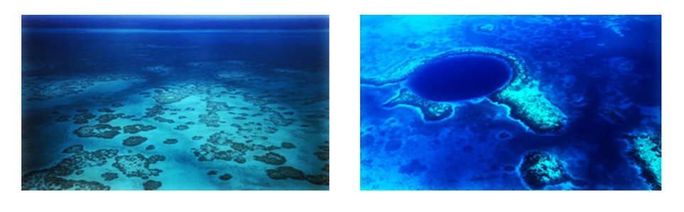
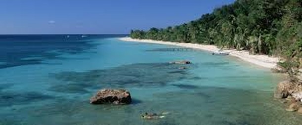
RESERVATION SYSTEM OF THE BARRIER REEF OF BELIZE
The Reservation System on the Barrier Reef of Belize is a series of coral reefs that are located at a variable distance from the coast of Belize, about 300 meters from the coast in the north and about 40 kilometers in the south. Has an approximate length of 300 kilometers, and is part of the Mesoamerican Barrier Reef System, the system of second largest coral reef in the world after the Great Barrier Reef of Australia. It is the most important touristic destination in Belize, attracting half of its 260,000 visitors, it is vital to its fishing industry.
Belice Reffs
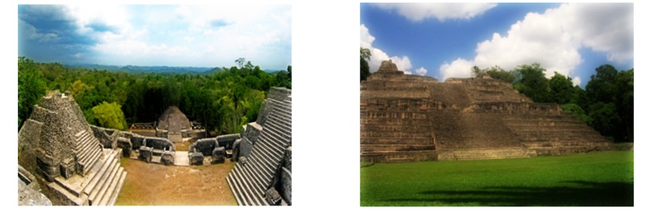
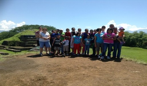
CARACOL, A MAYA CITY LOCATED IN BELICE
Caracol used to be a prominent city belonging to the Maya culture beganTo have a greater importance in the sixth century A.D. And in the present, its ruins are some of the more important that they are in the center toward the west of Belize, very close to the border with Guatemala. In this city where visitors can see several pyramids, royal tombs and a large collection of Mayan art. This place is located in the Forest Reserve Chiquibil, in Belize, for only about seventy-
Price: N/A
Tour Includes:
Transportation, Entrance fees and Professional Guide
GUATEMALA
GUATEMALA
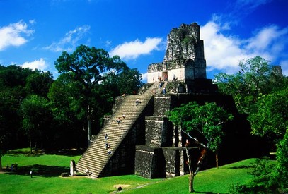
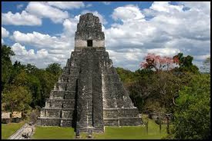
TIKAL
Tikal (or tik'al, in accordance with the modern Maya spelling) is one of the biggest archaeological site and urban centers of the pre-
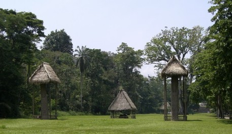
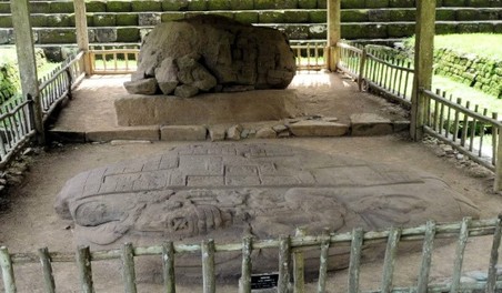
QUIRIGUA
Quirigua is an archaeological site belonging to the ancient Maya civilization, located in the department of Izabal in south-
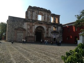
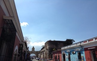
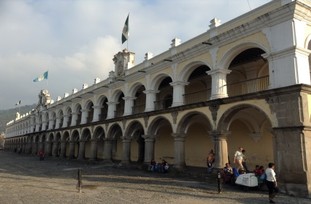
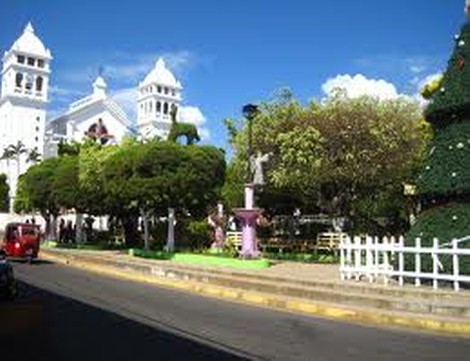
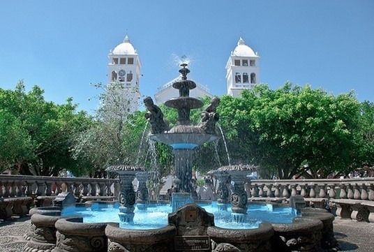
ANTIGUA GUATEMALA
The city of La Antigua Guatemala is the head of the homonymous municipality and the department of Sacatepequez, Guatemala. According to official census of 2003, has a population of 44,097 inhabitants. It is known for its well-
Price: N/a
Tour Includes:Transportation, Entrance fees and Professional Guide.
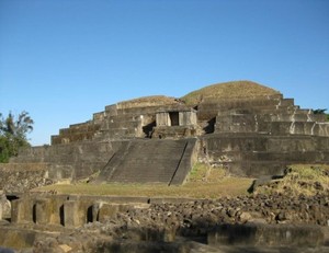
EL SALVADOR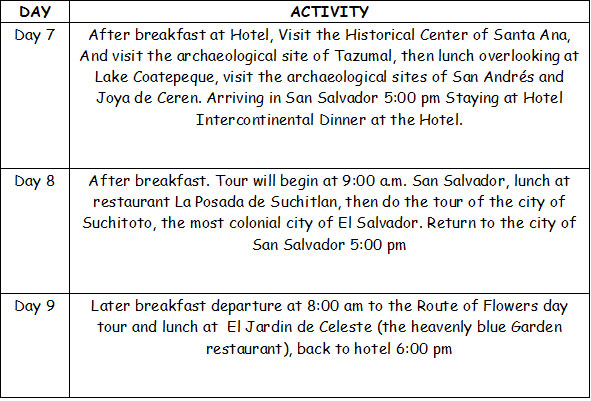
MAYA ROUTE IN EL SALVADOR
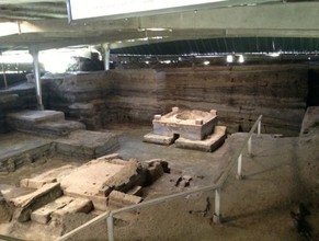
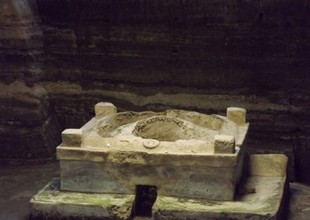
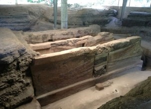
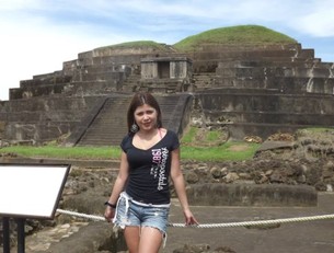
JOYA DE CERÉN
Located in the department of La Libertad, about 30 minutes from the capital this site was declared a World Heritage by UNESCO in 1993. This site shows the daily life of its indigenous people, interrupted by the eruption of the Loma Caldera volcano in 600 AD approx. Joya de Ceren has 18 structures, ten of which have been excavated, revealing hallways, doors, benches, steam, corn crops and home gardens. Apparently its inhabitants fled leaving largely intact natural phenomenon belongings and even the food being prepared at that time. Its preservation is due to more than 14 layers of ash that covered for more than 1,400 years, until it was discovered in 1976.
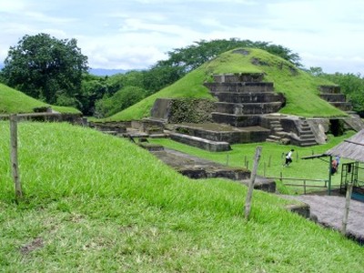
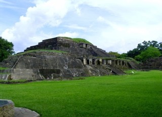
SAN ANDRÉS
32 km from San Salvador, and only 3 km away from Joya de Ceren, this archaeological site was a ceremonialcenter . San Andrés was a regional councilor center, ceremonial and administrative between 600 to 900 AD There is a indigo mill dating from the colonial era and was buried by the eruption of Playon in 1658 AD It was a place of important findings, including a religious scepter made of flint.
The complex has an area of approximately 35 hectares, one of the largest pre-
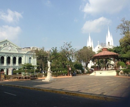
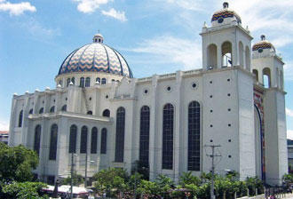
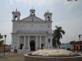
SANTA ANA CITY
The second largest city in the country is located 65 km west of San Salvador and has a variety of sites containing remains of prehispanic man occupation. The historic downtown of Santa Ana with the Cathedral, the National Theatre and the Palace are the most beautiful place in the country.
The Cathedral was declared Cultural Heritage in 1995, is a structure of more than 90 meters. Long, Gothic and Byzantine, of the most beautiful and best acoustics of El Salvador, was built in the first decade of the 20th century and inaugurated in 1910 with an opera by Giuseppe Verdi.
Today, Santa Ana is a city with a dynamic economy where the main product is coffee. It also has modern shopping centers and excellent tourist services infrastructure.
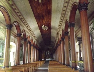
TAZUMAL RUINS
80 km from San Salvador, was formally registered in 1940. The occupation took place Tazumal from 1,500 BC Within its structure over 24 meters. high tombs were found with more than 116 vessels, jade jewelry, iron pyrite mirrors, fixtures and ceramic ballgame shaped lizard. This is a must for lovers of archeology, jade and reproductions of ancient pottery.
Opening hours: Tuesday to Sunday, from 9:00 am to 4:00 pm
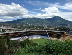
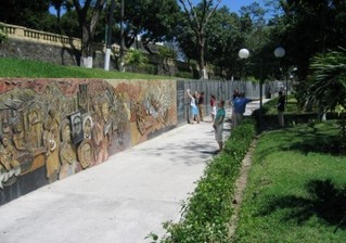
SAN SALVADOR CITY TOUR
Visit the two faces of the capital main residential areas of the city with the most important avenues, the handicraft market and the historic center of San Salvador where Metropolitan Cathedral, the National Palace, the mirror wall of the martyrs and the Rosary Church are located.
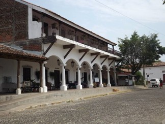
SUCHITOTO COLONIAL
Suchitoto is a municipality in the department of Cuscatlán, El Salvador. Their territory has been inhabited since pre-
THE FLOWERS ROUTE
Pleasant corridor running through one of the most flourishing areas of El Salvador, crossing between coffee forests, where the cool weather prevails, visit and interact in interesting places of culture and history, unique cuisine and direct contact with our natural resources.
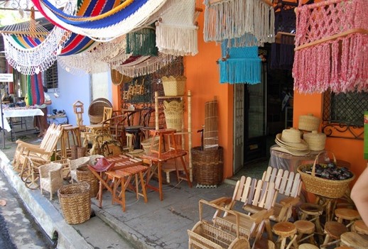
NAHUIZALCO
Bella City located 70 Kms from the capital with a strong presence of indigenous colonial church built in seventeenth century, its local economic heritage cottage industry based on natural fiber, wood, wicker, Tule, among others; Visit Artisan Development Center to learn about creativity and finesse of the laborious hands daily express beauty of these works, and Heritage Interpretation Center.
Salcoatitán: City of artists with art galleries and permanent exhibitions, located at 1045 meters above sea level, you can enjoy the typical food in the central square and admire its colonial style church recently rebuilt, the town where the first plant was grown Coffee virtuoso, Current assets for that town.
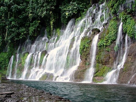
JUAYÚA
His name means "river of purple orchids" located at 1.025 meters, founded in 1877 with its name, its economy is based on coffee growing and production of ornamental plants, can enjoy their traditional food fair held every weekends, cannot miss the impressive waterfalls pristine and beautiful natural environment, savor the Gourmet coffee is produced and served in this cool community.
Apaneca: The city located at higher elevations of El Salvador to 1477 m.n.s.m Founded in 1577 as such, originating in one of the best coffees in the world, in their jurisdiction is Santa Leticia, very important archaeological site for its stone carvings of pre-
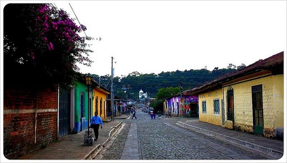
ATACO
A 1275 m.s.n.m, charming colonial city smelling old town of cobbled streets and colonial church belonging to the Izalcos from its inception until 1824 it became part of Sonsonate and then Ahuachapán, surrounded by coffee plantations and constantly decorated mist, will appreciate the development of textile yarns in their workshops still work with machines that craft. Also enjoy folk music in the main square weekend afternoons sipping drinks and traditional dishes.
Price: N/a
Tour Includes: Transportation, Entrance fees and Professional Guide.
HONDURAS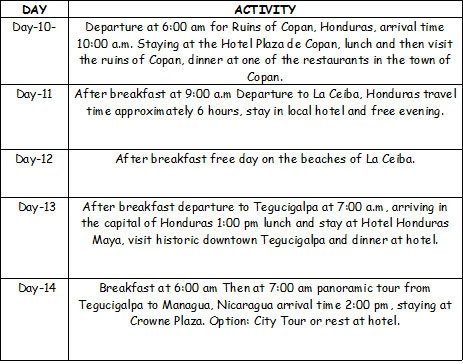
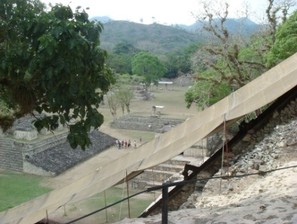
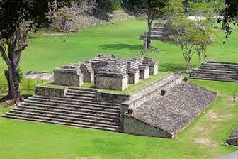
COPAN RUINS
Copán is an archaeological site of the ancient Maya civilization located in the department of Copán in western Honduras, not far from the border with Guatemala. V century to the ninth century was the capital of a major Classic period kingdom. The city was located in the extreme southeast of the Mesoamerican cultural region, on the border with isthmus-
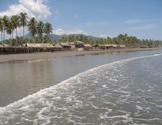
CEIBA BEACHES
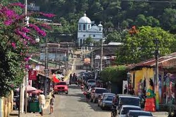
La Ceiba is the third largest city in Honduras and the head of the department and of the homonymous municipality Atlantis.
The first people who lived in this county were mostly Tolupanes, which were organized into tribes. They settled first in front of a Ceiba tree. In the nineteenth century, the inhabitants of this county are heavily concentrated in the banana industry. This municipality acquired the title of the August 23, 1877.
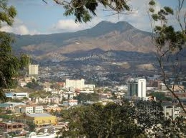
TEGUCIGALPA CAPITAL OF HONDURAS
Tegucigalpa is the capital of Honduras and seat of government of the Republic, with Comayagüela. Both cities make up the Central District. It is located in the center of the country and is its largest city. It is also one of the largest in Central America, the second most populous Central American isthmus (the first is Guatemala). Tegucigalpa is located on a plateau of about 990 meters, surrounded by hills, among which stands out in the north, Cerro El Picacho (1240 m.s.n.m). It has a population of 1,826.534 inhabitants (estimated 2011).
Price: N/a
Tour Includes:Transportation, Entrance fees and Professional Guide.
NICARAGUA
MANAGUA CITY
Managua founded with the name of Leal Villa de Santiago in Managua is now the capital of Nicaragua is located in Central America between Honduras and Costa Rica and has about 2,132,421 inhabitants and an aggregate of 2,300,000.
Managua is one of the capitals of Central warmer than its location in the tropics and not very tall (35 meters) in the day easily reach 35 ° C at night and 24 ° C.
LAKE NICARAGUA OR COCIBOLCA
The Great Lake of Nicaragua (or Lake Nicaragua) is a freshwater lake located in Nicaragua. It has an area of 8624 km ², the largest lake in Central America. Has inside more than 400 islets, three islands and two volcanoes.
For its size is the second largest lake in Latin America after Lake Maracaibo in Venezuela, and above Lake Titicaca (of similar size) extending between Bolivia and Peru. It is the largest in Central America and the ninth largest in America (and the 25th in the world).
Price: N/a
Tour Includes: Transportation, Entrance fees and Professional Guide.
COSTA RICA
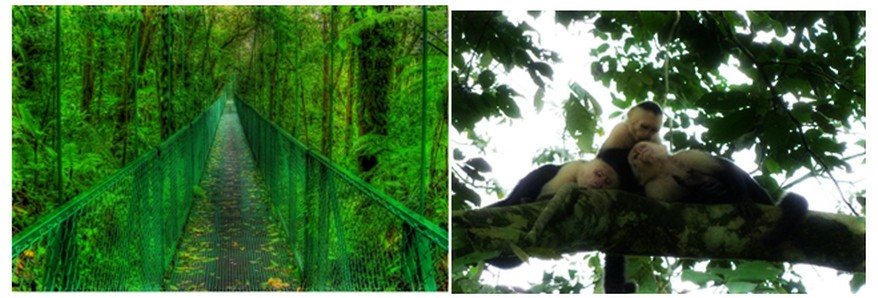
MONTE VERDE PARK
The Monte Verde Cloud Forest Reserve is a private reserve in Costa Rica located along the Cordillera de Tilarán between the provinces of Puntarenas and Alajuela.
Its name comes from the nearby town of Monte Verde and was founded in 1972. The reserve consists of more than 10,500 hectares of rainforest, and receives about 70,000 visitors a year. It has six ecological zones, 90% of which are virgin forest.
Scientists and tourists have since found a very high biodiversity, which consists of more than 2,500 species of plants (including most species of orchids in one place), 100 species of mammals, 400 species of birds, 120 species of reptiles and amphibians, and thousands of insects.
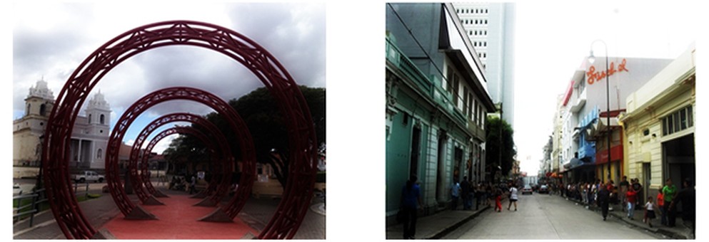
SAN JOSE CITY
San Jose is the capital of the Republic of Costa Rica and the capital of the province of the same name. Located in the center of the country, specifically on the plateau called intervolcánica Central Valley, San José is the political, economic, social and most importantly the Costa Rican territory, as well as the main node for transport and telecommunications. Culturally can be considered almost entirely with European influence on him by Spanish immigration from its discovery by Christopher Columbus, the Creole influence also imported from France and Belgium, where generally the privileged class was studying the country in the nineteenth century and early twentieth century. This can be seen in the distribution of the city that grew around the cathedral and later present the architecture of theaters, museums and houses of the inhabitants of the city center. The city is named in honor of Joseph of Nazareth.
Price: N/a
Tour Includes: Transportation, Entrance fees and Professional Guide.
PANAMA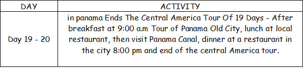
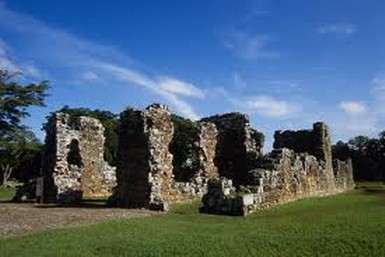
PANAMA OLD CITY
Old Panama or Panama Viejo is the name given to the archaeological site which was located in Panama City since its founding in 1519 until 1671. The city was moved to a new location; about 2 miles southwest, to be destroyed after an attack of the English pirate Henry Morgan, in the early 1670s. In the original city, regarded as the first European settlement on the Pacific coast of America, are today several ruins that make this archaeological site.
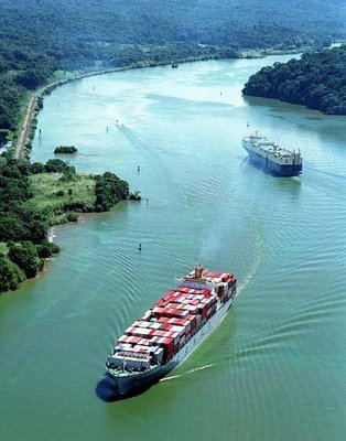
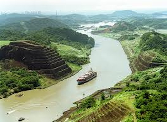
PANAMA CANAL
The Panama Canal is an inter-
Since it was inaugurated on August 15, 1914, has had a generously proportioned to shorten time and distance maritime communication, boosting trade and economic development by providing a path of short and relatively inexpensive transit between the two oceans, decisively influencing in world trade patterns, driving economic growth in developed countries and developing, and provides the basic drive for economic expansion in many remote regions of the world. United States and China are the main users of the Canal.
Before opening, the natural step used was the Magellan Strait, located at the southern tip of the continent, in Chile.
Price: N/a
Tour Includes: Transportation, Entrance fees and Professional Guide.